
Back to simple search | Back to advanced search
- Show this many records per page:10
- Workflow:Record published
- Institution:SF
- Thumbnail:Only records with images please
- Denomination:Uncertain
- Page:9
You searched for:

Record ID: SF5183
Object type: TOKEN
Broad period: MEDIEVAL
County: Cambridgeshire
Workflow stage: Published ![]()
Created on: Monday 2nd April 2001
Last updated: Thursday 24th February 2011
Spatial data recorded.
This findspot is known as 'CAMBRIDGESHIRE KENNETT', grid reference and parish protected.

Record ID: SF5023
Object type: JETTON
Broad period: MEDIEVAL
County: Suffolk
Workflow stage: Published ![]()
Created on: Monday 19th March 2001
Last updated: Thursday 24th February 2011
Spatial data recorded.
This findspot is known as 'SUFFOLK THORINGTON', grid reference and parish protected.

Record ID: SF4898
Object type: TOKEN
Broad period: MEDIEVAL
County: Cambridgeshire
Workflow stage: Published ![]()
Created on: Thursday 1st March 2001
Last updated: Thursday 24th February 2011
Spatial data recorded.
This findspot is known as 'CAMBRIDGESHIRE ELY', grid reference and parish protected.

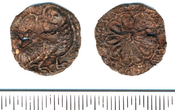
Record ID: SF4875
Object type: COIN WEIGHT
Broad period: MEDIEVAL
County: Suffolk
Workflow stage: Published ![]()
Sub-square coin weight (corners not right angles) struck on one face with a ship. The details are hard to see and I am not certain if the ship is empty or has a standing figure with shield. The ship is the right way up when the weight is held with one corner downwards. The weight is an odd colour - it appears to have retained its original bronze/gold colour without corrosion. It weighs 3.22 g, or 49.7 grains; it may have been to weigh a half-noble (60 grains 1351-1412, 54 grains 1412-64) or half-ryal (60 grains) and may date from 1351 to the 17th century. The later weights are mad…
Created on: Tuesday 27th February 2001
Last updated: Thursday 24th February 2011
Spatial data recorded.
This findspot is known as 'SUFFOLK WORLINGTON', grid reference and parish protected.

Record ID: SF4886
Object type: COIN
Broad period: MEDIEVAL
County: Suffolk
Workflow stage: Published ![]()
Created on: Tuesday 27th February 2001
Last updated: Thursday 24th February 2011
Spatial data recorded.
This findspot is known as 'SUFFOLK LACKFORD', grid reference and parish protected.

Record ID: SF4806
Object type: TOKEN
Broad period: POST MEDIEVAL
County: Suffolk
Workflow stage: Published ![]()
Created on: Monday 19th February 2001
Last updated: Friday 14th March 2014
Spatial data recorded.
This findspot is known as 'SUFFOLK NACTON', grid reference and parish protected.

Record ID: SF4753
Object type: TOKEN
Broad period: POST MEDIEVAL
County: Suffolk
Workflow stage: Published ![]()
Created on: Tuesday 13th February 2001
Last updated: Thursday 24th February 2011
Spatial data recorded.
This findspot is known as 'SUFFOLK EAST BERGHOLT', grid reference and parish protected.

Record ID: SF4754
Object type: TOKEN
Broad period: POST MEDIEVAL
County: Suffolk
Workflow stage: Published ![]()
Created on: Tuesday 13th February 2001
Last updated: Thursday 24th February 2011
Spatial data recorded.
This findspot is known as 'SUFFOLK EAST BERGHOLT', grid reference and parish protected.

Record ID: SF4699
Object type: TOKEN
Broad period: POST MEDIEVAL
County: Norfolk
Workflow stage: Published ![]()
Created on: Tuesday 6th February 2001
Last updated: Thursday 24th February 2011
Spatial data recorded.
This findspot is known as 'NORFOLK MERTON', grid reference and parish protected.
Record ID: SF4638
Object type: TOKEN
Broad period: MEDIEVAL
County: Suffolk
Workflow stage: Published ![]()
Created on: Friday 2nd February 2001
Last updated: Wednesday 11th September 2013
Spatial data recorded.
This findspot is known as 'SUFFOLK HORRINGER', grid reference and parish protected.
Records per page: 10 20 40 100
Sort your search by:
Which direction?
Total results available: 117
Search server index: asgard
You are viewing records: 81 - 90.
Search statistics
- Total quantity: 118
- Mean quantity: 1.009
- Maximum: 2
Filter your search
Object type
County of origin
Broad period
Institution
Ruler/issuer
Denomination
Mint
Material
Workflow
About Us
About our Site

Find us
The British Museum, Great Russell Street, London WC1B 3DG.
T: +44(0) 20 73238618