
Back to simple search | Back to advanced search
- Ruler:Uncertain - 4th century
- County:Lincolnshire
- Institution:WMID
- Page:2
You searched for:
Record ID: WMID-0C6A04
Object type: COIN
Broad period: ROMAN
County: Lincolnshire
Workflow stage: Awaiting validation ![]()
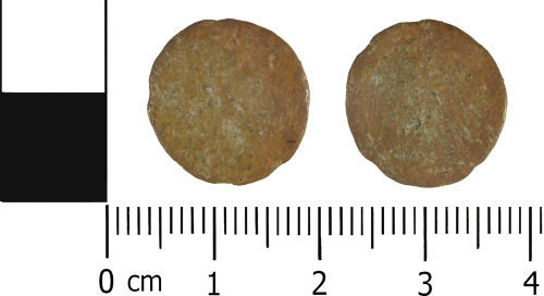
Roman coin: A complete struck / hammered copper alloy nummus, of uncertain Emperor and mint, but of 4th Century AD dating.
Diameter: 15.65mm
Thickness: 1.29mm
Weight: 1.3 grams
Created on: Friday 31st August 2012
Last updated: Friday 31st August 2012
Spatial data recorded.

Record ID: WMID-0C4A66
Object type: COIN
Broad period: ROMAN
County: Lincolnshire
Workflow stage: Awaiting validation ![]()
Roman coin: A complete struck / hammered copper alloy nummus, of uncertain Emperor and mint, but of 4th Century AD dating.
Diameter: 15.31mm
Thickness: 1.36mm
Weight: 1.3 grams
Created on: Friday 31st August 2012
Last updated: Friday 31st August 2012
Spatial data recorded.
Record ID: WMID-DADAD7
Object type: COIN
Broad period: ROMAN
County: Lincolnshire
Workflow stage: Awaiting validation ![]()
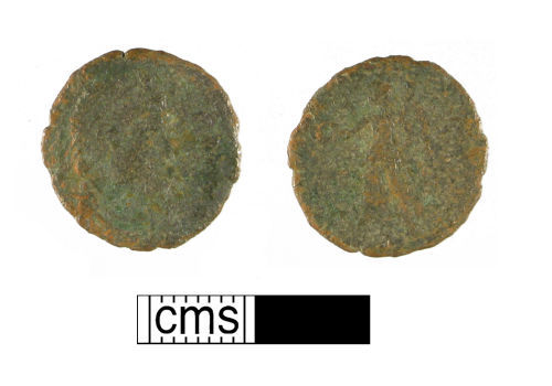
A worn copper-alloy Roman nummus of the fourth century AD, emperor uncertain, Victory reverse.
Created on: Tuesday 19th April 2011
Last updated: Tuesday 19th April 2011
Spatial data recorded.

Record ID: WMID-DA7635
Object type: COIN
Broad period: ROMAN
County: Lincolnshire
Workflow stage: Awaiting validation ![]()
A very worn copper-alloy Roman nummus of the fourth century AD, emperor uncertain.
Created on: Tuesday 19th April 2011
Last updated: Tuesday 19th April 2011
Spatial data recorded.

Record ID: WMID-D74AD0
Object type: COIN
Broad period: ROMAN
County: Lincolnshire
Workflow stage: Awaiting validation ![]()
A very worn copper-alloy Roman nummus of the fourth century AD.
Created on: Tuesday 19th April 2011
Last updated: Tuesday 19th April 2011
Spatial data recorded.
Record ID: WMID-D67936
Object type: COIN
Broad period: ROMAN
County: Lincolnshire
Workflow stage: Awaiting validation ![]()
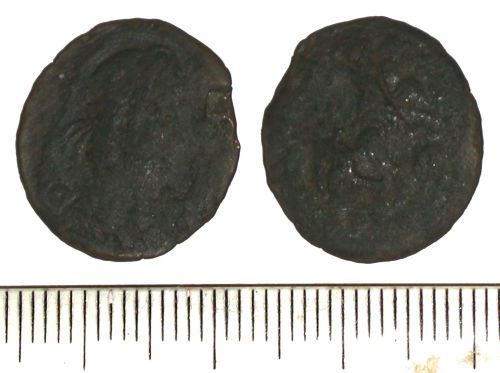
A complete struck/ hammered copper alloy nummus of a 4th century emperor, minted at an unknown location (diameter: 19mm; thickness: 1mm; weight: 1.9g). The coin is in a worn and poor condition.
Created on: Friday 18th May 2007
Last updated: Thursday 24th February 2011
Spatial data recorded.
This findspot is known as 'North Rauceby', grid reference and parish protected.
Records per page: 10 20 40 100
Sort your search by:
Which direction?
Total results available: 26
Search server index: asgard
You are viewing records: 21 - 26.
Search statistics
- Total quantity: 30
- Mean quantity: 1.154
- Maximum: 3
Filter your search
Object type
County of origin
Broad period
Institution
Ruler/issuer
Denomination
Material
Workflow
Reece Period
21 - 26 of 26 records.
About Us
About our Site

Find us
The British Museum, Great Russell Street, London WC1B 3DG.
T: +44(0) 20 73238618