
Back to simple search | Back to advanced search
- Complete:Complete
- Object type:COIN
- Show this many records per page:40
- Direction:desc
- Primary material:Base Silver
- ReeceID:Period 4: Flavian
- Ruler:Domitian
You searched for:

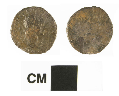
Record ID: HAMP-640608
Object type: COIN
Broad period: ROMAN
County: Hampshire
Workflow stage: Awaiting validation ![]()
A contemporary base metal (silver and copper alloy) copy of a Roman denarius of Domitian, reverse illegible, dating AD 85-96 (Reece period 4). The coin is worn and corroded with a brown patina.
Created on: Friday 15th November 2013
Last updated: Wednesday 20th November 2013
Spatial data recorded.
This findspot is known as 'Winchfield', grid reference and parish protected.
Record ID: WMID-092010
Object type: COIN
Broad period: ROMAN
County: Warwickshire
Workflow stage: Awaiting validation ![]()
A worn Roman base silver denarius of Domitian (81-96 AD).
Created on: Wednesday 15th September 2010
Last updated: Monday 21st May 2012
No spatial data available.

Record ID: CORN-FB21E5
Object type: COIN
Broad period: ROMAN
County: Cornwall
Workflow stage: Awaiting validation ![]()
Contemporary plated silver copy of a denarius of Domitian (AD 81-96), Caesar AD 69-81, COS II, c.AD 73, when Domitian was Caesar under Vespasian, Domitian on horseback on reverse with no legend, mint of Rome, BMC 122 (legend l to r) / BMC 129 (DOMIT), RIC 232.
Created on: Monday 6th November 2006
Last updated: Thursday 24th February 2011
Spatial data recorded.
This findspot is known as 'Padstow', grid reference and parish protected.

Record ID: SOMDOR-309E55
Object type: COIN
Broad period: ROMAN
County: Somerset
Workflow stage: Awaiting validation ![]()
Denarius of Domitian minted in Rome in AD 87. RIC no. 94 (vol. II, p. 165).
Created on: Thursday 11th May 2006
Last updated: Thursday 24th February 2011
Spatial data recorded.
This findspot is known as 'North Perrott area', grid reference and parish protected.
Records per page: 10 20 40 100
Sort your search by:
Which direction?
Total results available: 4
Search server index: valhalla
You are viewing records: 1 - 4.
Search statistics
- Total quantity: 4
- Mean quantity: 1.000
- Maximum: 1
Filter your search
Object type
County of origin
Broad period
Institution
Ruler/issuer
Denomination
Mint
Material
Workflow
Reece Period
1 - 4 of 4 records.
About Us
About our Site

Find us
The British Museum, Great Russell Street, London WC1B 3DG.
T: +44(0) 20 73238618